42 ACRES LAND OFF THE BEATEN PATH
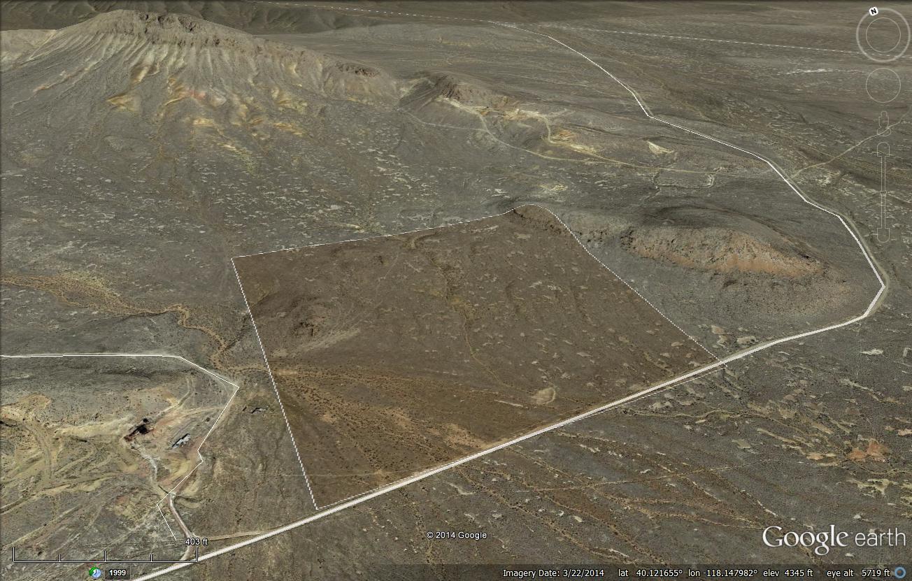
42.3 acres raw land. Easy access. A pleasant place for camping and off-road recreation, and/or potentially for your home, family, and animals. Beautiful desert mountain landscape with broad views, only 20+- minutes from Interstate 80. With close proximity to area employers such as the Relief Canyon mine and the Coeur Rochester mine, and easily commutable to the City of Lovelock, this could prove the perfect location for settling into. Expansive and tranquil views of mountains and desert in all directions.
Zoned AMR (agriculture, mining, recreation), which allows a wide variety of potential uses including building a home (Buyer to do their own due diligence as to all potential uses).
A well traveled dirt road reaches the property at its western boundary, and continues eastward beyond to rejoin Antelope Road about 1.5 miles east of the property. The nearest services are in the City of Lovelock, 30+- minutes away. Lovelock is located about 1.25 hours east of Reno, and an hour west of Winnemucca, both of which lie along Interstate 80.
This is an off-grid location. Solar or wind appear to be the best methods of generating electricity, or alternatively electric lines are located about half a mile away. Water is typically obtained via private well and sewage disposal via private septic tank. Propane delivery service is available in the area.
Property to be sold as-is, where-is. Buyer to conduct their own due diligence in all aspects including with regard to development possibilities, utilities, etc to ensure property meets Buyer’s needs.
Pershing County APN 015-710-09
Directions: Take Interstate 80 east from Reno. Exit at Coal Canyon Road, which is exit 112. Upon exiting, turn right onto Coal Canyon Road. Reset your odometer and go 13.1 miles, then turn left onto Antelope Road. Reset your odometer again, and proceed straight (east) on this road for 1.3 miles, then turn right onto Pershing Mine Road. Four wheel drive vehicle with good clearance recommended from this point, as the road becomes dirt/gravel and rough in some areas. Reset your odometer once more, and drive southeasterly on Pershing Mine Road for a total of 2.8 miles, bearing left at the forks you come to at approximately 1.7 and 2.5 miles. At this point you will be on the property. There is a for sale sign on the property near the point where this road crosses onto the property. See attached images and maps to assist you in identifying the property. There is no official street number yet for the property, so please type the GPS coordinates into Google Maps to locate the property; an official street address will be assigned by the County at the time of building.
GPS 40.119670, -118.149410 (southwest portion of property at road)
What3Words ///waging.gazed.decorative